En
Log in
All resources
Create a design
Tools
7,118 Free Images of Engraved Maps
copper engraving print
british library
joan blaeu
baroque
engravings of topographia braunschweig lüneburg
1667 maps
maps from the earth and its inhabitants, vol. iv
atlas maior, vol 1 (northern europe, norway, and denmark) - joan blaeu, 1667 - bl 114.h(star).1
eran laor cartographic collection
atlas maior, vol 7 (france i) - joan blaeu, 1667 - bl 114.h(star).7
engravings of topographia braunschweig lüneburg
baroque
engravings of topographia braunschweig lüneburg
baroque
engravings of topographia braunschweig lüneburg
baroque
engravings of topographia braunschweig lüneburg
baroque
engravings of topographia braunschweig lüneburg
baroque
engravings of topographia braunschweig lüneburg
baroque
engravings of topographia braunschweig lüneburg
baroque
engravings of topographia braunschweig lüneburg
baroque
engravings of topographia braunschweig lüneburg
baroque
engravings of topographia braunschweig lüneburg
baroque
1858 van de velde maps of palestine and jerusalem
eran laor cartographic collection
1858 van de velde maps of palestine and jerusalem
eran laor cartographic collection
1858 van de velde maps of palestine and jerusalem
eran laor cartographic collection
1656 in berlin
1656 maps
collections of the blanton museum of art
maps by alexis-hubert jaillot
atlas maior, vol 4 (netherlands) - joan blaeu, 1667 - bl 114.h(star).4
1667 maps
atlas maior, vol 1 (northern europe, norway, and denmark) - joan blaeu, 1667 - bl 114.h(star).1
1667 maps
atlas maior, vol 8 (france ii and switzerland) - joan blaeu, 1667 - bl 114.h(star).8
1667 maps
atlas maior, vol 2 (sweden, russia, poland, eastern europe, and greece) - joan blaeu, 1667 - bl 114.h(star).2
maps of candia by ortelius and mercator
atlas maior, vol 8 (france ii and switzerland) - joan blaeu, 1667 - bl 114.h(star).8
1667 maps
atlas maior, vol 1 (northern europe, norway, and denmark) - joan blaeu, 1667 - bl 114.h(star).1
1667 maps
atlas maior, vol 7 (france i) - joan blaeu, 1667 - bl 114.h(star).7
1667 maps
atlas maior, vol 7 (france i) - joan blaeu, 1667 - bl 114.h(star).7
1667 maps
atlas maior, vol 1 (northern europe, norway, and denmark) - joan blaeu, 1667 - bl 114.h(star).1
1667 maps
atlas maior, vol 3 (germany) - joan blaeu, 1667 - bl 114.h(star).3
17th-century maps of silesia
atlas maior, vol 2 (sweden, russia, poland, eastern europe, and greece) - joan blaeu, 1667 - bl 114.h(star).2
17th-century maps of romania
atlas maior, vol 1 (northern europe, norway, and denmark) - joan blaeu, 1667 - bl 114.h(star).1
1667 maps
atlas maior, vol 3 (germany) - joan blaeu, 1667 - bl 114.h(star).3
17th-century maps of silesia
maps of paris from the david rumsey historical map collection
plan de roussel
maps by pieter mortier
le neptune francois
prints by johan frederik clemens in the statens museum for kunst
engraving
prints by johan frederik clemens in the statens museum for kunst
engraving
foret de soignes - zonienwoud
jacob van werden
eran laor cartographic collection
raymond bonheur
maps from university of amsterdam special collections
atlas der neederlanden
prints of cartouches in the rijksmuseum amsterdam
maps in the rijksmuseum amsterdam
celeberrimi fluvii albis nova delineatio by willem janszoon blaeu
maps in the staats- und universitätsbibliothek hamburg
maps from the earth and its inhabitants, vol. xi
roads in tunisia
maps from the earth and its inhabitants, vol. xvii
linguistic maps of north america
maps from the earth and its inhabitants, vol. xi
oases of libya
maps from the earth and its inhabitants, vol. iv
cirencester
maps from the earth and its inhabitants, vol. iv
19th-century double hemisphere world maps
maps from the earth and its inhabitants, vol. xiii
19th-century maps of madagascar
maps from the earth and its inhabitants, vol. xvi
19th-century maps of mexico city
maps from the earth and its inhabitants, vol. v
ringkjøbing
maps from the earth and its inhabitants, vol. xiv
exploration of australia
maps from the earth and its inhabitants, vol. xviii
south america in the 19th century
maps from the earth and its inhabitants, vol. xiii
maps of journeys
maps from the earth and its inhabitants, vol. xiii
old maps of luanda
maps from the earth and its inhabitants, vol. iv
romney marsh
maps from the earth and its inhabitants, vol. xvi
19th-century maps of jamaica
maps of the districts of the canton of bern
biel/bienne (administrative district)
maps from the earth and its inhabitants, vol. iv
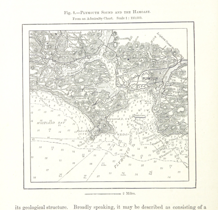
charts of plymouth sound
maps from the earth and its inhabitants, vol. vi
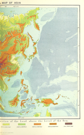
topographic maps of asia
1610s maps of the iberian peninsula
maps by jodocus hondius
old maps of viceroyalty of the caucasus
19th-century maps of crimea
old maps of castilla la nueva
1765 maps of spain
engravings of topographia braunschweig lüneburg
baroque
engravings of topographia braunschweig lüneburg
baroque
topographia braunschweig lüneburg (merian)
baroque
engravings of topographia braunschweig lüneburg
baroque
maps by willem and johannes blaeu
1617 maps of africa
atlas maior, vol 9 (italy) - joan blaeu, 1667 - bl 114.h(star).9
1667 maps of italy
atlas maior, vol 7 (france i) - joan blaeu, 1667 - bl 114.h(star).7
17th-century maps of xaintonge
atlas maior, vol 7 (france i) - joan blaeu, 1667 - bl 114.h(star).7
1667 maps
atlas maior, vol 1 (northern europe, norway, and denmark) - joan blaeu, 1667 - bl 114.h(star).1
1667 maps of europe
atlas maior, vol 9 (italy) - joan blaeu, 1667 - bl 114.h(star).9
1667 maps of italy
atlas maior, vol 9 (italy) - joan blaeu, 1667 - bl 114.h(star).9
1667 maps of italy
atlas maior, vol 3 (germany) - joan blaeu, 1667 - bl 114.h(star).3
17th-century maps of silesia
atlas maior, vol 1 (northern europe, norway, and denmark) - joan blaeu, 1667 - bl 114.h(star).1
1667 maps
atlas maior, vol 1 (northern europe, norway, and denmark) - joan blaeu, 1667 - bl 114.h(star).1
1667 maps
atlas maior, vol 8 (france ii and switzerland) - joan blaeu, 1667 - bl 114.h(star).8
1667 maps
atlas maior, vol 5 (england) - joan blaeu, 1667 - bl 114.h(star).5
17th-century maps of the british isles
atlas maior, vol 3 (germany) - joan blaeu, 1667 - bl 114.h(star).3
17th-century maps of silesia
17th-century maps of cornwall
maps in the british museum
engravings of topographia braunschweig lüneburg
baroque
engravings of topographia braunschweig lüneburg
baroque
buildings of the principality of lüneburg
baroque
engravings of topographia braunschweig lüneburg
baroque
maps of wachtendonk
frans hogenberg
maps from the earth and its inhabitants, vol. iv
peterborough
maps from the earth and its inhabitants, vol. x
khedivate of egypt
maps from the earth and its inhabitants, vol. vii
19th-century maps of korea
maps from the earth and its inhabitants, vol. iv
19th-century maps of derbyshire
maps of rivers of south sudan
sobat river
maps from the earth and its inhabitants, vol. v
maps of the north atlantic
maps from the earth and its inhabitants, vol. xi
maps indicating exploration
maps from the earth and its inhabitants, vol. iv
sewers in london
rivers of the western cape
maps of the western cape
maps from the earth and its inhabitants, vol. iv
lowestoft
maps from the earth and its inhabitants, vol. iv
milford haven
maps from the earth and its inhabitants, vol. iv
rhins of galloway
maps from the earth and its inhabitants, vol. x
john hanning speke
maps from the earth and its inhabitants, vol. vii
charles eugène perron
maps from the earth and its inhabitants, vol. vii
provinces of japan
maps from the earth and its inhabitants, vol. xiv
maps of voyages
1870s maps of venezuela
1878 in venezuela
maps from the earth and its inhabitants, vol. xvii
old maps of washington, d.c.
prints by johan frederik clemens in the statens museum for kunst
engraving
copper engravings in the universitätsbibliothek salzburg
wolf-dietrich-klebeband städtebilder
1901 - 2000 of 7,118
Next page
/ 72